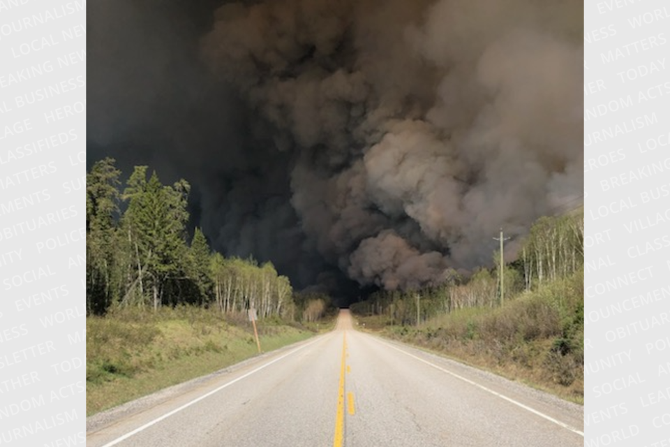
WHITE RIVER — Part of the road connecting Highway 17 and Highway 11 remains closed this morning due to a forest fire.
Highway 631 is closed in both directions between White River and Hornepayne, according to 511. The closure has been in effect since around 4:30 p.m. on May 29.
A Ministry of Natural Resources forest fire map shows two fires in the White River area. Wawa 3 is listed as active and not under control at 800 hectares. It started on May 27 and is located in the Kakakiwibik Esker north of Highway 17.
Wawa 2 is also not under control and was last listed as being around 105 hectares. It started on May 26 and is south of Highway 17 and Crocker's Lake, about 5.5 kilometres west of White River.
Monday, the MNR reported five new fires in the northeast region, including Chapleau 1 which was confirmed yesterday morning. It's located six kilometres east of Chapleau, just under a kilometre south of Gallagher Lake. As of last night, the 2.3 hectare fire is not under control.
A number of fires remain active in the region, including Timmins 2 which is east of Highway 144 in the Mamie Lake area. It started on May 28 and is listed as being held at 2 hectares in size.
The fire hazard across Ontario, according to the MNR, is high to extreme. There is currently no fire ban in Timmins.