The Timmins 2 fire near Gogama increased in size from 700 to 6,000 hectares between Saturday and Sunday, according to a fire situation update provided by Aviation, Forest Fire and Emergency Services.
The fire is currently classed as not under control, and as of Sunday night, was about four kilometres west of the community of Gogama.
The fire is burning on the west side of Highway 144 and running parallel to the roadway.
Officials were concerned overnight Sunday that the fire might cross Highway 144, so the highway was closed as a precaution. It was reopened early Monday morning.
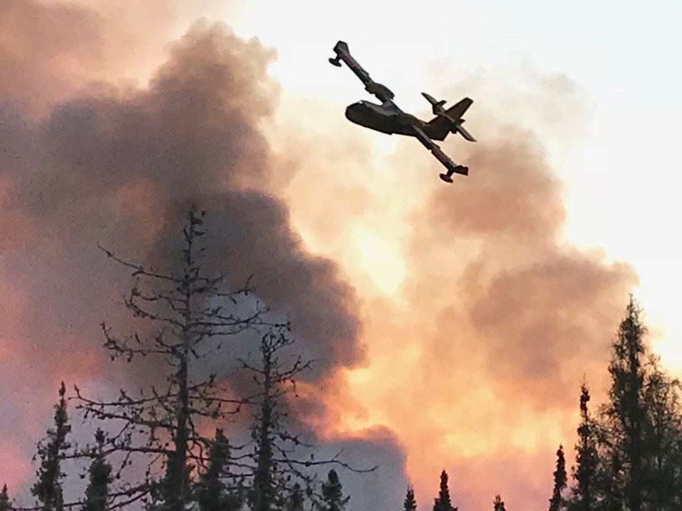
Aggressive aerial fire suppression took place Saturday and Sunday. FireRangers are on the ground attacking the fire’s perimeter in a strategic and co-ordinated manner.
Sunday's combination of warm temperatures, moderate winds and low relative humidity permitted Timmins 2 to grow and increase in size.
But Monday's rainy weather and cool temperatures will help air and ground attack efforts, said the press release.
The fire is being fought by 11 FireRanger crews, CL-415 Waterbombers and Twin Otters and three helicopters.
As a precautionary measure, the Ministry of Natural Resources and Forestry’s Timmins District has recommended to the Gogama Local Services Board, that a two-hour evacuation alert notice be in place for residents in the Gogama and surrounding areas.
The community of Gogama currently has a voluntary evacuation in place.
This fire was confirmed on June 6, and like all wildland fires in Ontario, the cause of this fire will be investigated.
Residents in areas north of Gogama such as Mattagami First Nation, Kenogamissi Lake, Timmins, South Porcupine, Porcupine and Nighthawk Lake may experience smoke drift.
Smoke drift depends heavily on the direction of wind; when the winds shift, the smoke drift will also shift.
There were two new fires in Northeastern Ontario as of Sunday evening.
Sudbury 6 is located on the south shore of the French River, approximately eight kilometres southeast of Ouellette. The 0.2 hectare fire is not under control.
Parry Sound 3 is located approximately 11 kilometres northeast of Britt. The fire is out at 0.1 hectares.
The forest fire hazard is high to extreme throughout the Northeast Region.
For up to date forest fire hazard conditions in your area, see the interactive fire map at Ontario.ca/forestfire.
To report a forest fire located north of the French and Mattawa rivers, dial 310-FIRE.
To report a forest fire located south of the French or Mattawa rivers, dial 911.