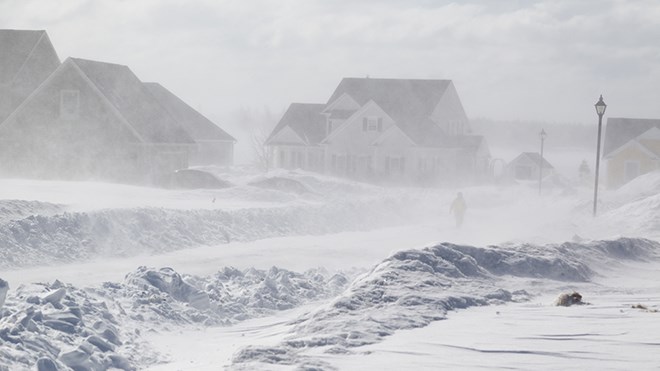
Environment Canada has issued a blizzard warning for Greater Sudbury's surrounding area, potentially adding to the winter storm expected over the weekend.
Issued:
- Batchawana Bay
- Blind River
- Killarney
- Manitoulin
- Montreal River Harbour
- Sault Ste. Marie
- Searchmont
- St. Joseph Island
The areas listed above are expecting or experiencing blizzard conditions, with gusty winds and visibility near zero in blowing snow.
By Sunday afternoon, blizzard conditions and 70-100 km/h winds will have reached the areas listed above and will persist into Monday morning.
Snowfall beginning Sunday afternoon will amount to 10-15 cm by Sunday night.
Winds are expected to calm through the day on Monday, improving visibility.
Strong winds such as these have the potential to damage a building, such as to roof shingles and windows, said Environment Canada.
High winds may toss loose objects or cause tree branches to break, increasing the risk of a power outage.
Note that a freezing rain warning is also in effect for tonight into Sunday morning.
Motorists are advised to postpone non-essential travel, with conditions expected to be extremely hazardous. Road closures are possible.
Environment Canada issues blizzard warnings when a large area experiences reduced visibility of 400 meters or less for at least four hours.