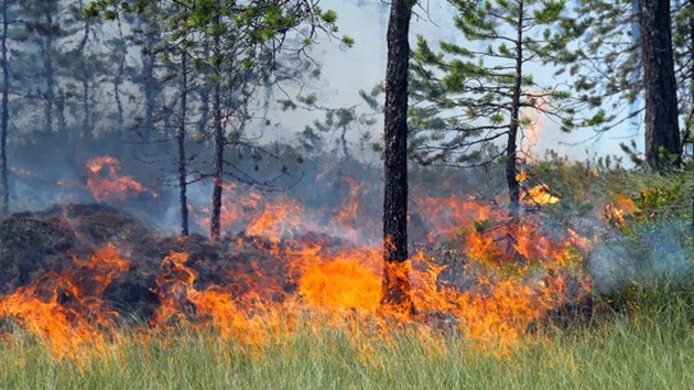
There were five new forest fires in the Northeast Region by late afternoon, Aug. 5.
- Algonquin Park 17 is not under control at 0.1 of a hectare
- Parry Sound 40 is not under control at 0.1 of a hectare
- Peterborough 2 is not under control at 1 hectare
- Sault Ste. Marie 38 is not under control at 0.5 of a hectare
- Sudbury 86 is not under control at 0.1 of a hectare
There are currently 26 active forest fires in the region:
- Algonquin Park 15 is under control at 0.1 of a hectare
- Bancroft 19 is under control at 0.8 of a hectare
- Bancroft 21 is being held at 0.3 of a hectare
- Chapleau 12 is under control at 0.1 of a hectare
- Cochrane 9 is being observed at 3 hectares
- Cochrane 10 is being observed at 1 hectare
- Cochrane 11 is being observed at 15 hectares
- Hearst 12 is being held at 5 hectares
- North Bay 35 is being held at 1 hectare
- North Bay 38 is being held at 0.9 of a hectare
- North Bay 39 is being held at 0.5 of a hectare
- Parry Sound 39 is under control at 0.3 of a hectare
- Pembroke 5 is under control at 1.5 hectares
- Sault Ste. Marie 35 is being held at 0.2 of a hectare
- Sudbury 30 is under control at 0.3 of a hectare
- Sudbury 78 is under control at 0.9 of a hectare
- Sudbury 80 is under control at 1 hectare
- Sudbury 84 is under control at 0.1 of a hectare
- Sudbury 85 is not under control at 0.4 of a hectare
- Wawa 28 is under control at 0.1 of a hectare
Fire of note:
North Bay 32 located 12.5 km west of Latchford, measures 59 hectares and its status is currently listed as not under control. There are no imminent threats to values or structures at this time. 2 helicopters are performing aerial fire suppression today, and 6 ground crews are committed to the fire.
They are performing sustained attack. The FireRangers are continuing to work at establishing the hose line around the perimeter of the forest fire.
AFFES would like to remind the public who may be travelling in the area to proceed with caution and to drive slowly, as vehicles and crews are on scene and visibility may be reduced due to smoke.
To see a complete list of new, active and extinguished fires across the province click on our interactive map. You can also get the latest update on the condition of any fire by simply clicking the fire icon.
The forest fire hazard is low to extreme across of the region, with most areas south of Timmins holding a high to extreme hazard.
For more information about the current fire situation and the active fires map: ontario.ca/forestfire.
To view the Fire Danger Rating for your area, simply click the “view map” icon, then “select map layers”. Check off the “Fire Danger Rating” option.