There were five new fires discovered in the Northeast Region reported as of yesterday evening, three of which are located within Greater Sudbury area.
The first, Sudbury 5, is located by a rail corridor near Ruby Lake approximately 11 km west of Alban, and is being held at 0.6 hectares. Sudbury four is near the western shore of Lake Wanapitei, around 6.5 km east of Capreol, and is being held at 0.1 hectares.
The third fire was found approximately 13 km north of Capreol, but was suppressed overnight.
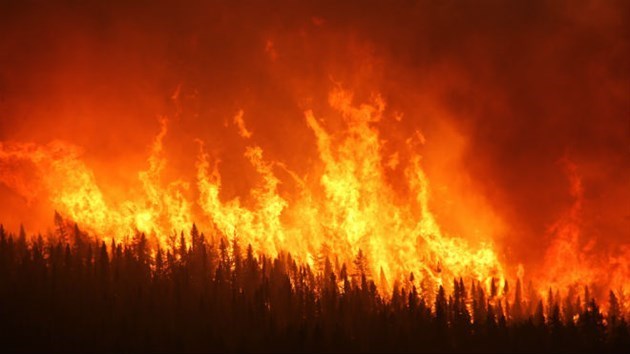
There are currently 13 active fires in the Northeast Region, including Timmins 2, an active forest fire burning on the west side of Hwy 144 which resulted in a voluntary evacuation order for Gogama.
The fire was discovered June 6, roughly four km west of Gogama, and now covers 700 hectares. The fire appears to be spreading north, but had not crossed Hwy 144 as of 10:30 p.m. last night.
Smoke from the flames has resulted in the closure of Hwy 144 south of the watershed in both directions, from the intersection of Hwy 144 and Hwy 560, to the intersection of Hwy 144 and Hwy 661.
Water bombers, heavy equipment and 11 FireRanger crews have been assigned to the fire, which has required aerial fire suppression every day since it was discovered, said AFE in a press release.
Members of the Gogama Fire Department will be located at the Gogama Community Centre 24/h a day for the time being, with a bus on standyby in the event of an evacuation. Residents interested in evacuating voluntarily are asked to sign-out at the Gogama Community Centre, or in the front lobby of the Microtel in Timmins.
Anyone with additional questions is asked to contact Gogama Fire Service's Fire Chief Christine Cloutier, at 705-288-7178 or the Gogama Local Service Board at 705-894-2555.
For up to date forest fire hazard conditions in your area, see the interactive fire map at Ontario.ca/forestfire.