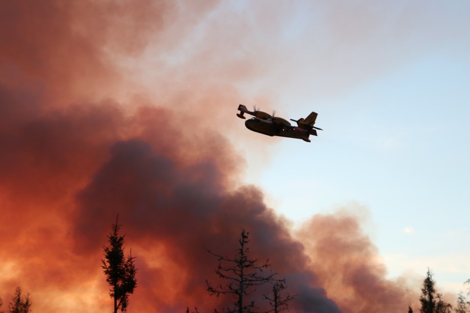
The Timmins 2 forest fire near Gogama has been remapped, and is now listed as being 4,645 hectares, according to a fire situation updated issued by Aviation, Forest Fire and Emergency Services late Sunday afternoon.
That's about 1,000 hectares less than was reported last week.
The fire is still classed as “not under control.”
Timmins 2 remains about four kilometres west of the community of Gogama. Ground crews continue to consolidate hose lines and are patrolling 100 feet in from the perimeter for hot spots.
There were no new fires in the Northeast Region by late afternoon on June 16. At the time of the update, the fire hazard is low to moderate across the Northeast.
Pursuant to the Emergency Area Order signed June 11, an Implementation Order has been issued by the Ministry of Natural Resources and Forestry prohibiting access and travel in portions of Timmins District where there are public safety hazards as a result of fire activity from Timmins 2.
The Order restricts travel, access and use in an identified area (see attached map below) and may be modified regularly to reflect changing fire conditions.
This measure has been put in place to ensure public safety while allowing fire personnel to safely and effectively suppress the fires in the identified area.
All travel and use of Jack Road from the intersection of Jack Road and Highway 144, westerly to the Ontario Power Generation Mesomekenda Lake Dam, at Mesomekenda Lake is prohibited.
All use and occupation of Crown Land or within 500 metres of the described closed roads within this area is prohibited.
If a member of the public believes that access within the restricted travel area is necessary for non-recreational purposes, phone 705-235-1334 to request a travel authorization permit. MNRF will review the request for access based on the rationale provided, local fire activity and the potential fire risk.
Visit ontario.ca/forestfire to view the current access restrictions and fire activity as this site is being updated regularly.