Updated Feb. 2 at 12:10 p.m.
Both an extreme cold warning and a snow squall watch are now in effect for Greater Sudbury and vicinity.
The snow squall watch issued early Thursday morning has now been upgraded to a snow squall warning.
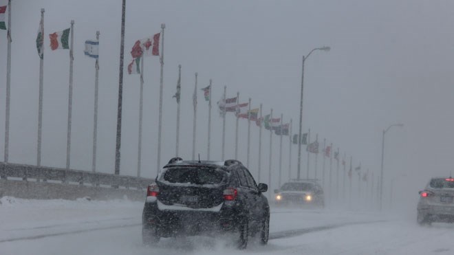
Periods of brief but intense snowfall are expected throughout this afternoon, said the snow squall warning, issued at 11:40 a.m. by Environment Canada. Visibilities will be rapidly reduced due to the heavy snow combined with blowing snow.
“Bands of heavy snow are traversing the area with the passage of an arctic cold front,” the snow squall warning added.
“Heavy snow combined with northwesterly winds gusting 50 to 70 km/h could produce near zero visibility. Bitterly cold air will follow in the wake of the front with extreme wind chill values expected tonight into Friday morning.
“Visibility will be suddenly reduced to near zero at times in heavy snow and blowing snow. Be prepared to adjust your driving with changing road conditions.”
An extreme cold warning for Greater Sudbury and vicinity was also issued at around 11 a.m. Thursday morning.
“Widespread wind chills of minus 40 to minus 45 are expected tonight into Friday morning,” said the warning from Environment Canada.
“Extreme cold wind chills are expected once again Friday night into Saturday morning for some areas. Temperatures will moderate through the day on Saturday bringing an end to the extreme cold spell.
“Risks are greater for young children, older adults, people with chronic illnesses, people working or exercising outdoors, and those without proper shelter. Watch for cold related symptoms: shortness of breath, chest pain, muscle pain and weakness, numbness and colour change in fingers and toes.
“Cover up. Frostbite can develop within minutes on exposed skin, especially with wind chill. Check on older family, friends and neighbours. If it's too cold for you to stay outside, it's too cold for your pet to stay outside.”
Original story:
A snow squall watch is in effect for Greater Sudbury and vicinity.
Environment Canada said a brief but intense snow squall associated with a fast moving arctic cold front will push southeastward across northeastern Ontario this morning into this afternoon. Heavy snow combined with northwesterly winds gusting 50 to 70 km/h may produce near zero visibility. Snowfall accumulations of two to five centimetres in an hour or two are possible.
Bitterly cold air will follow in the wake of the front with extreme wind chill values expected tonight into Friday morning.
Snow squalls cause weather conditions to vary considerably; changes from clear skies to heavy snow within just a few kilometres are common.
Travel may be hazardous due to sudden changes in the weather. Visibility may be significantly and suddenly reduced to near zero.