Sudburians were treated to some unseasonably mild temperatures throughout January, and the month finished up as the fifth warmest on record in nearly 100 years.
The average high for January 2020 in Sudbury was -4.1 degrees C, with the average low coming in at -12.5 degrees C, for a mean average temperature of -8.3 degrees C.
In terms of seasonal averages, Sudbury's mean average temperature for January - the coldest month of the year - is -12.9 degrees C, colder than what the average low was this year.
That mean average temperature of -8.3 C comes in as the fifth warmest on record for Sudbury, and the average high of -4 C ranks as the sixth warmest.
Sudbury's warmest January in terms of the average high was 30 years ago in 1990, when the average max temperature was -2.6 degrees C.
Fast forward six years from the warmest January, 1996 was the coldest on record, where the average high was a bitter -15.9 degrees C.
While Sudburians coasted through January 2020 with relative ease and Wiarton Willie predicted an early spring for Ontario, Weather Network meteorologist Doug Gillham says that Northern Ontario residents shouldn't get too comfortable just yet.
"Mid-winter warmth is not a signal for an early spring," said Gillham. "Generally when the weather goes easy on us early and in the middle of winter we pay for it later."
Sudbury and most of Canada were very fortunate in January, as temperatures soared across the country. A trio of winter weather factors played into the country seeing temperatures you'd more likely associate with March during what is generally the coldest month of the year.
"We had two reversals in our drivers of the winter pattern, in a year like this where we don't have El Nino or La Nina, we don't have a strong driver," said Gillham.
"We have to look at water temperatures and patterns in the oceans. One of the anticipated drivers of the winter forecast was a large pool of relatively warm water in the north Pacific, it was a very persistent feature through the fall and it was until around Jan. 1 and we thought we were in shape for it to tip our pattern to cold, but that has disappeared. We've seen a reversal in the water temperature pattern in that region so we lost our driver for cold."
Meteorologists have also been tracking a substantial warming of the waters north of Australia, which is a known driver of warmth over the eastern United States and into Canada.
"We lost a driver for cold and gained a driver for warm," said Gillham. "We also expected the polar vortex to be more organized this winter and it has been, but it's been sitting over the pole and even on the other side of the pole where we thought it would be sitting over Hudson Bay. All those three combined has just caused the country to be flooded with Pacific air and for Arctic air to almost be absent."
According to the Weather Network's projections for February, Sudbury won't be battered too bad with frigid weather, but after a mild January it will feel more harsh.
"February is looking like more of a typical month, there's going to be a lot more Arctic air across Canada, and we think the temperature for Ontario, including Sudbury, will be closer to normal," said Gillham.
Sudbury's average high in February is -5.5 C, which may not sound terribly cold, but that temperature is in large part due to the month warming up as it goes along. Environment Canada is forecasting highs of -12 C and -14 C on Friday and Saturday this week, with the low dipping to -25 C on Saturday.
"The highs will be climbing, but this means that February will actually be colder than January was, which is not the way it normally goes," said Gillham.
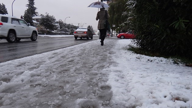
A mild January that saw multiple days at or slightly above the freezing mark, coupled with days of rain, have lent to snow accumulation being held mostly in check, despite the fact that Sudbury has actually received far more snow than it normally does.
"What's interesting is that despite the more gentle winter, you're running well above normal for snowfall," said Gillham.
"You've had 229.5 cm so far this winter and normal for this point of the season is 164 cm. Even Toronto is running above normal and nobody believes that because there's no snow on the ground. They get snow and then it melts."
The peak of the cold weather is likely to hit around mid-February and slowly climb from that point on and into spring, but Gillham says that Sudburians shouldn't expect a stretch of unseasonably warm weather like they saw in January.
"You might get some mild days here and there, but we're not going to see extended periods of mild weather and certainly we think there will be more cold days in the mix than not," said Gillham.
"By then end you'll likely end up within a degree of normal, but expect more of a typical month than what you saw in January."