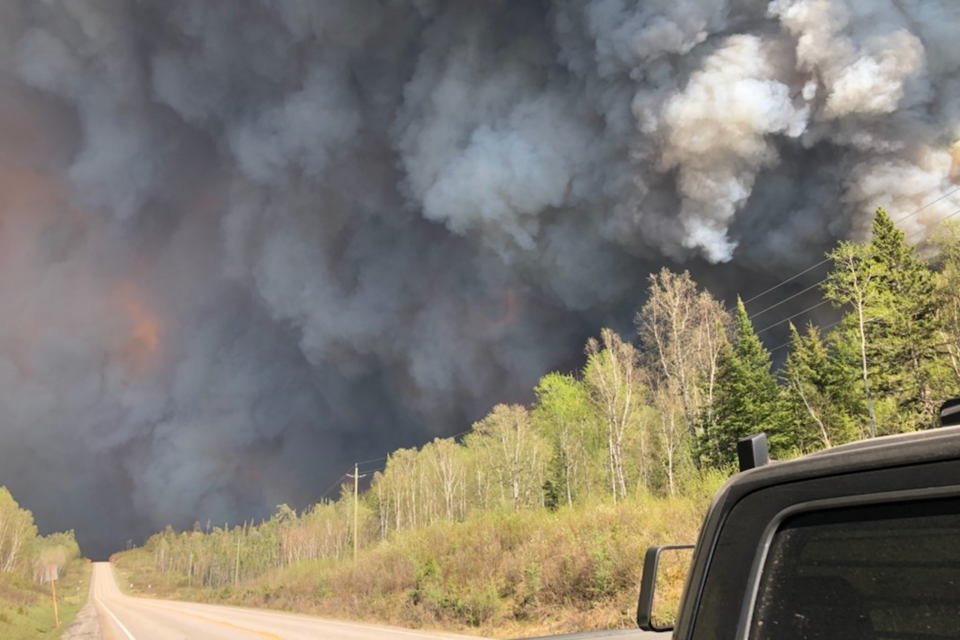
The Sudbury 17 fire, which is burning about 96 km west of the city, remains out of control today, and remains at more than 4,200 hectares in size.
Fire crews in that area are conducting suppression work and trying as much as possible to protect property.
The Emergency Area Order declared on June 5 Ministry of Natural Resources and Forestry (MNRF) remains in effected parts of the Sudbury District.
The following areas must be evacuated immediately: the Townships of; Olinyk, Plourde (south half), Prescott, Redden (west half), Strain, Teasdale, Poncet, Lehman, Lockeyer, Gerow and Gaiashik, unless authorized by a travel permit issued by the Ministry of Natural Resources and Forestry. You can also view the Implementation Order map.
The implementation order also restricts travel on the following roads, unless you're in possession of an authorized travel permit issued by the Sudbury District MNRF office. The Implementation Order map also outlines these travel restrictions.
Travel, use, and access is restricted on the following roads:
- Highway 553 (also known as the Massey Tote Rd) south of Cameron Creek
- West Branch Rd south of Fleck Creek in Weeks Township
- Highway 810 (also known as the Massey Tote Rd) south of Ritchie Falls
- John's Creek Rd at Porter Creek
- Fox Lake Rd at Centre Creek
- Kitt’s Creek Rd at Boon Twp. Rd (Boon Township boundary)
- Highway 553 (also known as the Massey Tote Rd) in Olinyk Township, south of Gervais Township
- Pecors Rd at the Joubin, Gaiashik Township boundary
As of Thursday evening, there are two new confirmed fires in the region.
- Chapleau 9 is located 19 kilometres south of Highway 101 and 1 kilometre west of Turner Lake. The 0.3-hectare fire is not under control.
- Sault Ste Marie 7 is located one kilometre south of Gull Lake and six kilometres north of Goulais Lake, nestled just outside the Algoma Headwater Provincial Park. The 0.7- hectare fire is not under control.
Including new fires, there are currently 34 active fires in the Northeast Region:
Fires currently under control include, Sudbury 13 at 0.1 hectares, Cochrane 9 at five hectares, Cochrane 2 at 0.4 hectares, and Wawa 2 at 105 hectares, Timmins 8 at 0.8 hectares, Hearst 4 at 12 hectares, Kirkland Lake 6 at 0.2 hectares, Sault Ste Marie 3 at 2.8, Algonquin Park 6 at 30 hectares.
- Fires being held include:
- Pembrooke 1 at 43.7 hectares
- Cochrane 8 at 35 hectares
- Cochrane 3 at 80 hectares
- Sudbury 16 at 14.1 hectares
- Sudbury 15 at 3.4 hectares
- Algonquin Park 7 at 2.1 hectares
- Sault Ste Marie 5 at three hectares
- Sault Ste Marie 6 at four hectares.
- Fires currently not yet under control:
- Kirkland Lake 5 at 2100 hectares
- Timmins 7 at 120 hectares
- Cochrane 7 at 7071 hectares
- Cochrane 6 at 1239 hectares
- Cochrane 5 at 11 hectares
- Hearst 5 at 90 hectares
- Sault Ste Marie 4 at 14 hectares
- Sudbury 19 at 253 hectares
- Sudbury 18 at 1.5 hectares
- Sudbury 17 at 5277 hectares
- Sudbury 11 at 31 hectares
- Sudbury 10 at 958 hectares
- Chapleau 8 at 0.2 hectares
- Chapleau 6 at 458 hectares
- Chapleau 3 at 3134 hectares
- Wawa 3 at 6678 hectares.
Restricted Fire Zone
Due to the extreme forest fire hazard, the Ministry of Natural Resources and Forestry has declared a Restricted Fire Zone effective Thursday, June 1, at 12:01 a.m. local time for the districts of Hearst/Cochrane/Kapuskasing, Chapleau/Wawa, Timmins/Kirkland Lake, Sault Ste Marie/Blind River, Sudbury, North Bay, Minden/Parry Sound/Bracebridge, Pembroke, a northern portion of the Peterborough/Bancroft District, and the southeastern portion of the Far North District. No open air burning, including campfires, is permitted within the boundaries of a Restricted Fire Zone. Portable gas or propane stoves may be used for cooking and warmth BUT must be handled with extreme caution. All burning permits are suspended. The Restricted Fire Zone is in place until further notice. Visit Ontario.ca/forest fire for more details and follow us on Twitter @ONforestfires.