The cool, gloomy weather continues to aid firefighters in their efforts to tame the Timmins 2 fire near Gogama.
Burning four kilometres from the small community two hours north of Greater Sudbury on Highway 144, the fire has been mapped at about 5,600 hectares in size. It is burning along the west side of Highway 144.
A voluntary evacuation order remains in place for the Gogama area, with the Ministry of Natural Resources and Forestry continuing to recommend residents be ready to evacuate within two hours should the need arise.
As a health precaution, nearby Mattagami First Nation evacuated 30 young children and elderly people Saturday night when smoke was at its thickest. Those people were able to return home on Sunday.
Some 25 mm of rain fell on parts of the fire on June 10, soaking the fire and helping firefighters in their suppression efforts. The rain also resulted in minimal fire activity continuing on Tuesday.
“Fire activity continued to be relatively quiet today,” the latest update from the MNRF stated late Tuesday.
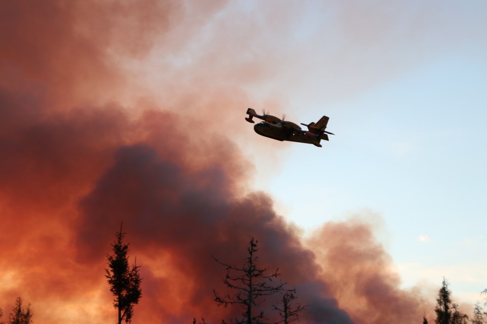
The ministry has committed an incident management team, 20 FireRanger crews, CL-415 Waterbombers and Twin Otters when needed, seven helicopters and heavy equipment to build fuel breaks around the fire. A small basecamp has been established in Gogama.
Travel restrictions
Highway 144 was opened and closed to traffic several times over the past few days, but remains open at this time. Travellers are advised to monitor the changing conditions using Ontario511 or @OPPCommunicationsNER on Twitter, and Ontario Provincial Police-Northeast Region on Facebook.
As part of the Emergency Area Order signed June 10, the ministry has issued an Implementation Order prohibiting access and travel in portions of Timmins District where there are public safety hazards as a result of fire activity from Timmins 2.
All travel and use of Jack Road from the intersection of Jack Road and Highway 144, west to the Ontario Power Generation Mesomekenda Lake Dam at Mesomekenda Lake is prohibited. All travel and use of Gogama Unit Road from the intersection of Highway 144 and the Gogama Unit Road, north to the north end of Carter Township is prohibited, as well.
All use and occupation of Crown Land or within 500 metres of the described closed roads within this area is prohibited.
If a member of the public believes that access within the restricted travel area is necessary for non-recreational purposes, please call 705-235-1334 to request a travel authorization permit.
Visit Ontario.ca/forestfire to view the current access restrictions and fire activity as this site is being updated regularly.
Across the northeast
As of the early evening of June 11, there are three active wildland fires in the region.
Chapleau 4 is located north of Hwy 101 between Timmins and Chapleau. It is being held at 16.5 hectares. Sudbury 2 is under control at 0.2 of a hectare, on the southwest side of Windy Lake. Sudbury 6, north of the French River, has been declared out.
At the time of this update, the fire hazard is mostly low in the Northeast region; with the exception of the western sides of the Cochrane and Wawa districts, which are showing a moderate to high hazard.