The Ministry of Natural Resources & Forestry has issued a flood outlook for the Sudbury district.
A flood outlook gives early notice of the potential for flooding based on weather forecasts calling for heavy rain, snow melt, high winds or other conditions.
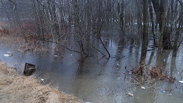
The key watersheds included in this statement are the French River, Aux Sables River, Spanish River, Wanapitei River, Veuve River and Vermillion River.
Residents in these areas should keep a close watch on conditions, regularly check for updated messages and stay away from fast-moving rivers and streams.
MNRF is closely monitoring the weather and developing watershed conditions. Further updates will be issued as appropriate.
Day time high temperatures across central and northern Ontario range from 10 to 15 C, which nighttime lows of 0 C up until Thursday, when a cooling trend will drive daytime high temperatures down to around around 0 C, with sub-zero nighttime lows.
The current forecast shows this cooler weather persisting into early next week across the north. There is the possibility of rain early Wednesday morning and through the day Thursday.
Water levels and flows across much of the lower portion of northeastern Ontario are expected to remain elevated through the coming week from past precipitation and snow melt.
Runoff from the remaining snow pack will increase through the beginning of this week as warm temperatures contribute to or maintain existing high water levels throughout Sudbury District watersheds.
Further north, snow melt is occurring, and water levels and flows are rising as the snow pack ripens and begins to release water. If the forecast precipitation on Thursday materializes, melt and runoff will be exacerbated.
As the temperatures begin to drop by Thursday the melt will slow and the rapidly rising flows and levels will likely continue to increase but at a slower rate.
A close watch on local forecasts and conditions is recommended.