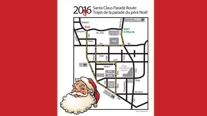
The Greater Sudbury Santa Claus Parade gets underway at 5:30 p.m. on Saturday, Nov. 19.
Make sure you're familiar with the parade route so you can stake out your spot to watch the parade go by.
Get the full-sized, printable parade route map here.
If you're heading down to the parade this Saturday, be sure to do so early as there will be a number of road closures.
Southbound lanes on Notre Dame Avenue will close between Kathleen Street and Ste. Anne Road at 1 p.m.
The downtown core will close to vehicle traffic from 4:45 p.m. to approximately 8 p.m. The area bordered by Kathleen, Davidson, College and MacKenzie will close to through traffic.
Access will be maintained for local traffic. Brady Street, between Paris and Douglas Streets, will close for over an hour shortly after the start of the parade.
Parking is not permitted along the parade route, including Elm, Durham, Minto, and Elgin Streets. Parking in municipal lots is free of charge.
Larch Street will be closed, between Durham Street and Elgin Street, from 8 a.m. to 10 p.m. for the Annual Santa Watch Party.
Parking is not permitted on Murray Street as Emergency Services and Transit will be using this as a detour around Notre Dame Avenue.
Detours will be in effect for Greater Sudbury Transit routes in downtown Sudbury. For more information, dial 705-675-3333.
More information about the Greater Sudbury Santa Claus Parade is available at www.sudburysantaclausparade.com.